

West Virginia and Landsat
Links
- Document: Report (5.33 MB pdf) , HTML , XML
- Download citation as: RIS | Dublin Core
Abstract
Many may recall “Take Me Home, Country Roads,” made famous by John Denver, leads with the lyric “almost heaven, West Virginia, Blue Ridge Mountains, Shenandoah River.” The descriptors are apt. Nicknamed the “Mountain State,” West Virginia inspires thoughts of coal mining or logging in the Appalachian Mountains and valleys, or the leaping trout in the winding waters of Shenandoah National Park.
West Virginia is second only to Wyoming in coal production nationwide. Its mines produced more than 67 million tons of coal in 2020 (U.S. Energy Information Administration, 2021). Logging pumped about $3.4 billion into the State’s economy in 2019 (Gabbert, 2019); tourist spending added another $4.6 billion (Dean Runyan Associates, 2019).
Those industries are key for West Virginia, but agriculture and fisheries also play a role in the State's economic fortunes. Peaches and apples are major drivers of food production, as are beef and poultry. Trout, meanwhile, are caught and sold commercially, and are stocked throughout the State's rivers for local and visiting anglers.
Scientists, land managers, and others use imagery from the USGS Landsat satellite program's deep historical archive to better understand and manage West Virginia’s storied forests, fields, mountains, and foothills.
Here are just a few examples of how Landsat benefits the State.
Monitoring Surface Mines
Southern West Virginia is home to mountaintop removal mining, which began mostly in the 1990s. The Landsat Program’s nearly 50-year record of Earth surface imagery makes it an unparalleled resource for monitoring mine growth, movement, and reclamation. Scientists have used Landsat to track changes to surface mining activity since the 1970s. Today, commercial cloud platforms can be used to scan more than three decades of imagery for mining activity. One study determined that mining had disturbed 1,120 square miles of land area in central Appalachia between 1985 and 2015 (Pericak and others, 2018).
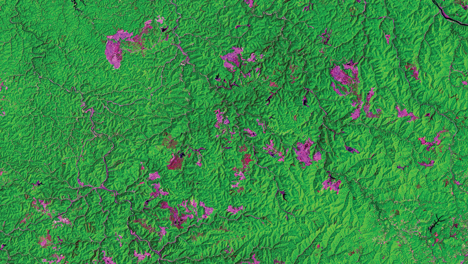
Landsat 5 image showing surface mining southwest of Charleston. The pink areas represent mine-related disturbances.
Tracking Forest Change
More than 75 percent of West Virginia is forested. The State’s forests face threats from wildfire, drought, disease, and invasive species. Landsat is used by projects like the National Land Cover Database (NLCD) to map tree cover and land cover. The maps help land managers understand changes to forests over time. Landsat imagery also enables the study of specific forest management questions in places like the Monongahela National Forest. In 2019, researchers used Landsat imagery and topographic information to track the effect on trees from mining and logging, and the extent and pace of their recovery (Dialesandro and others, 2019).
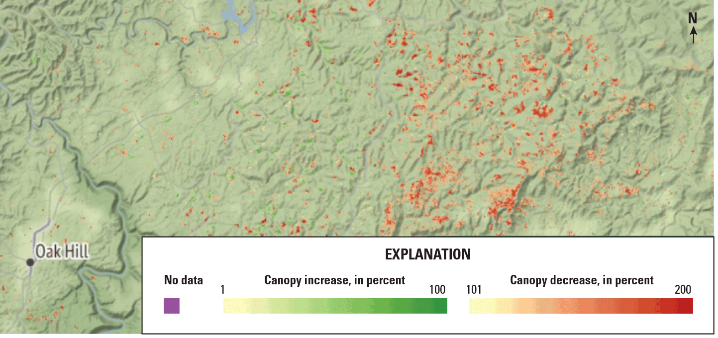
National Land Cover Database (NLCD) tree canopy change, derived from Landsat data, east of Oak Hill. Map credit: U.S. Geological Survey.
Managing Aquatic Ecosystems
West Virginia’s fisheries are important cultural and economic resources. Landsat imagery can be folded into research that improves the understanding of the landscape and how disturbances to it might affect aquatic ecosystems. Landsat’s Operational Land Imager (OLI) can see bands of light beyond those visible to the human eye, such as the near infrared and shortwave infrared bands of the electromagnetic spectrum. OLI can help capture photosynthetic activity such as algal blooms in lakes and rivers. Landsat data are among the water-quality monitoring sources listed in the Ohio River Valley Water Sanitation Commission’s (ORSANCO’s) Harmful Algal Bloom Monitoring and Response Communication Plan (ORSANCO, 2021).
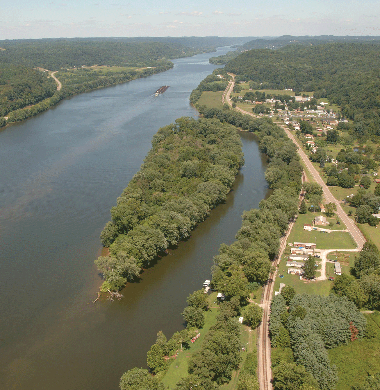
The Ohio River Islands Refuge in West Virginia. Photograph credit: Janet Butler, U.S. Fish and Wildlife Service.
National Land Imaging Program Benefits—West Virginia
The U.S. Geological Survey (USGS) National Land Imaging Program provides a wide range of satellite imagery and other remotely sensed and geospatial data to Government, commercial, academic, and public users. Those users can get worldwide access to Landsat satellite data through the National Land Imaging Program-funded USGS Earth Resources Observation and Science (EROS) Center.
Landsat—Critical Information Infrastructure for the Nation
Landsat is the most widely used land remote sensing data source within Federal civilian agencies. Local, State, Tribal, and Federal agencies use Landsat to monitor and forecast a wide range of land surface phenomena. Information from Landsat contributes to day-to-day decisions on land, water, and resource use that protect life and property; safeguard the environment; advance science, technology, and education; support climate resiliency; and grow the U.S. economy. Landsat’s imagery provides a landscape-level view of land surface, inland lake, and coastal processes, both natural and human-induced. Landsat enables us to better understand the scope, nature, and speed of change to the natural and built environment.
Businesses draw upon Landsat data to provide customer-specific applications to improve logistics, resource allocation, and investment decisions. Commercial space imaging firms leverage Landsat data to refine product offerings and support new information services. A 2017 USGS study determined the total annual economic benefit of Landsat data in the United States. to be $2.06 billion, far surpassing its development and operating costs (Straub and others, 2019).
Landsat 8 and Landsat 9 provide 8-day repeat coverage of the Earth’s land surfaces. The National Aeronautics and Space Administration (NASA) and the USGS are currently reviewing the findings from a joint Architecture Study Team, which will inform the design and implementation approach for Landsat Next, the follow-on mission to Landsat 9. Landsat 9 and its successors are planned to provide a sustainable, space-based system to extend the 50-year Landsat series of high-quality global land imaging measurements—the world’s longest time series of the Earth’s land surface.
The long-term availability of consistent and accurate Landsat data, combined with a no-cost data policy, allows users to analyze extensive geographic areas and better understand and manage long-term trends in land surface change. New cloud computing and data analytics technologies use Landsat data in a wide range of decision-support tools for Government and industry. Much like global positioning systems and weather data, Landsat data are used every day to help us better understand our dynamic planet.
References Cited
Dean Runyan Associates, 2019, West Virginia travel impacts 2000–2018p: Charleston, Prepared for the West Virginia Tourism Office by Dean Runyan Associates, accessed March 10, 2022, at https://wvtourism.com/wp-content/uploads/2019/10/2019.10.15-Travel-Impacts_Final_Web.pdf.
Dialesandro, J., Bull, M., Francis, T., Yut, K., Weber, K., Spruce, J., and Jarnevich, C., 2019, West Virginia ecological forecasting: National Aeronautics and Space Administration DEVELOP National Program, 18 p., accessed May 25, 2021, at https://giscenter.isu.edu/research/Techpg/nasa_DEVELOP/pdf/2019Summer_TechPaper.pdf.
Gabbert, C.C., 2019, The economic contribution of West Virginia's forest products industry: West Virginia University, master’s thesis, accessed March 10, 2022, at https://researchrepository.wvu.edu/etd/3837.
Ohio River Valley Water Sanitation Commission [ORSANCO], 2021, ORSANCO harmful algae bloom monitoring, response and communication plan—Final: ORSANCO, 26 p., accessed March 10, 2022, at https://www.orsanco.org/wp-content/uploads/2021/02/FINAL-2021-HAB-Monitoring-and-Response-Plan.pdf.
Pericak, A.A., Thomas, C.J., Kroodsma, D.A., Wasson, M.F., Ross, M.R.V., Clinton, N.E., Campagna, D.J., Franklin, Y., Bernhardt, E.S., and Amos, J.F., 2018, Mapping the yearly extent of surface coal mining in Central Appalachia using Landsat and Google Earth Engine: PLoS One, v. 13, no. 7, p. e0197758, accessed March 10, 2022, at https://doi.org/10.1371/journal.pone.0197758.
Straub, C.L., Koontz, S.R., and Loomis, J.B., 2019, Economic valuation of Landsat imagery: U.S. Geological Survey Open-File Report 2019–1112, 13 p., accessed April 8, 2022, at https://doi.org/10.3133/ofr20191112.
U.S. Energy Information Administration, 2021, West Virginia—State profile and energy estimates—Overview: EIA web page, digital data, accessed March 10, 2022, at https://www.eia.gov/state/?sid=WV.
For additional information on Landsat, please contact:
Program Coordinator
USGS National Land Imaging Program
12201 Sunrise Valley Drive
Reston, VA 20192
703–648–4567
The Landsat series is a joint effort of USGS and NASA. NASA develops and launches the spacecraft; USGS manages satellite operations, ground reception, data archiving, product generation, and data distribution. Funding for the National Land Imaging Program’s Landsat operations and data management is provided through the USGS.
Suggested Citation
U.S. Geological Survey, 2022, West Virginia and Landsat: U.S. Geological Survey Fact Sheet 2022–3044, 2 p., https://doi.org/10.3133/fs20223044.
ISSN: 2327-6932 (online)
ISSN: 2327-6916 (print)
Study Area
| Publication type | Report |
|---|---|
| Publication Subtype | USGS Numbered Series |
| Title | West Virginia and Landsat |
| Series title | Fact Sheet |
| Series number | 2022-3044 |
| DOI | 10.3133/fs20223044 |
| Year Published | 2022 |
| Language | English |
| Publisher | U.S. Geological Survey |
| Publisher location | Reston, VA |
| Contributing office(s) | Earth Resources Observation and Science (EROS) Center |
| Description | 2 p. |
| Country | United States |
| State | West Virginia |
| Online Only (Y/N) | N |
| Google Analytic Metrics | Metrics page |