

The EDMAP Program: Training the Next Generation of Geologic Mappers
Links
- Document: Report (1.92 MB pdf) , HTML , XML
- Superseded Publications:
- Download citation as: RIS | Dublin Core
Introduction
Detailed geologic maps are the basis of most earth science investigations and can be used for natural hazard mitigation, resource identification and exploration, infrastructure planning, and more. As a part of the U.S. Geological Survey (USGS) congressionally mandated National Cooperative Geologic Mapping Program (NCGMP), the EDMAP program (referred to as EDMAP) is a partnership between the USGS and participating colleges and universities that provides mentorship and training opportunities for earth science students nationwide. EDMAP supports graduate students and upper-level undergraduate students—under the guidance of a faculty member who serves as a “principal investigator”—for the training of students to become geologic mappers. Between 1996 and 2021, EDMAP funded geologic mapping educational experiences and training for 1,373 students at more than 170 universities.
Through cooperative agreements, EDMAP provides educational experiences and helps develop the skills needed for earth science students to learn geologic mapping and how to analyze earth science data. A principal investigator may request up to $35,000 to support a graduate student and up to $25,000 to support an undergraduate student, inclusive of all administrative and overhead costs, and every Federal dollar is matched 1:1 by the proposing institution. Matching funds may include the following:
-
a direct financial match in dollars to cover project expenses;
-
faculty salary (whether the principal investigator or not) or student salary;
-
volunteer services provided by professional and technical personnel, consultants, or other skilled or unskilled labor if the services are an integral and necessary part of the project;
-
purchased, rented, or donated property, such as field supplies, laboratory supplies, or office supplies justified to support the project—note that the value of donated property must not exceed the fair market value of the property at the time of the donation;
-
field travel and accommodations; and
-
sample preparation and analysis costs.
The skills required for geologic mapping change as technologies evolve. In order to improve the ability of scientists and researchers to support new USGS and State geological survey initiatives and priorities, technological changes prompted the USGS to extend the range of opportunities available through EDMAP. There are now two options for proposed projects:
For both options, EDMAP continues to be a 1-year, mentor-guided program requiring a field component and the production of a geologic map.Field-Focused Projects mirror previous EDMAP project requirements, prioritizing field mapping and requiring the delivery of a geologic map. Data Synthesis Projects reflect the expanded scope of EDMAP and focus on data-driven, computational, or technology-focused earth science research themes. Data Synthesis Projects may have deliverables such as remote sensing data, a machine learning algorithm, or a smartphone application. However, a Data Synthesis Project must also produce a geologic map and include a mentored field experience. The USGS hopes that diversity among participating institutions and students is enhanced by expanding the range of opportunities funded under EDMAP.
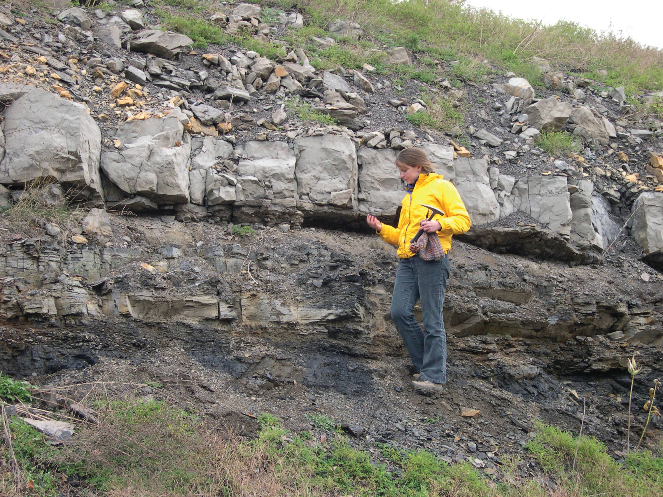
Geologic Mapping: Photograph of researcher working on geologic mapping of Pennsylvanian-age strata in eastern West Virginia. Photograph by Christopher S. Swezey, U.S. Geological Survey.
Who may apply for EDMAP?
-
Proposals must be written and submitted by faculty or adjunct faculty from an accredited university in the United States or a U.S. Territory.
-
Eligible university departments include (but are not limited to) geology, geoscience, earth science, geography, environmental science, hydrology, and geological engineering.
-
Collaborations between more than one institution are permissible and encouraged.
The EDMAP Program: Field-Focused Projects and Data Synthesis Projects
Field-Focused Projects
EDMAP Field-Focused Projects must focus on the production of a geologic map as the basis of a mentored geologic field-mapping experience. For Field-Focused Projects, funding requests can be up to $35,000 for each graduate student primary mapper and $25,000 for each undergraduate student primary mapper, per year. The expected deliverable is a geologic map.
Data Synthesis Projects
EDMAP Data Synthesis Projects should focus on learning and applying geoscience-relevant, data-driven skills and techniques (such as machine learning, geographic information systems, and modeling) to generate a geologic map. The proposed project must include an approved, mentored field experience. For example, a proposed project could be the development of a smartphone application to assist with rock identification in the field.
For EDMAP Data Synthesis Projects, funding requests can be up to $35,000 for each graduate student and $25,000 for each undergraduate student, per year. The required deliverables include a geologic map and any products or data generated during the project, such as remote sensing data, software code (for example, a new software package), or digital applications.
Testimonials
-
“The EDMAP Program was a very important experience for me, professionally and personally.”—Evan Laughlin, 2019 EDMAP recipient at the College of William and Mary.
-
“EDMAP was very valuable to my graduate studies and development as a geoscientist, and I’m glad to see the program flourishing.”—Jens-Erik Lund Snee, 2012 EDMAP recipient at Stanford University and current USGS Mendenhall Postdoctoral Fellow.
-
“EDMAP was one of the most rewarding experiences of my life, the chance to spend two months in the rugged Grand Mesa National Forest mapping the geology was challenging and educational.”—Julian Chesnutt, 2017 EDMAP recipient at North Carolina State University.
-
“I loved participating in the EDMAP Program!”—Shelby Isom, 2016 EDMAP recipient at Portland State University.
-
“The EDMAP Program was extremely helpful for my education and has helped me get to where I am today.”—Neal Mankins, 2016 EDMAP recipient at Oregon State University.
Ongoing Case Study—Mapping Recently Discovered Complex Faulting to Understand Seismic Hazards to Local Infrastructure and Human Life
A team of faculty and students at Western Washington University proposed an EDMAP project in 2021 titled “New Surficial Geologic Map of the Western Sadie Creek Fault System, Olympic Peninsula, Washington.” The team intends to map a complex pattern of faulting along the western Sadie Creek fault, which is located on the northern flank of the Olympic Peninsula in Washington State. This faulting was recently discovered by an airborne light detection and ranging (lidar) study of the Olympic Peninsula. The goal of this study is to use lidar data and surficial geologic mapping to determine the kinematics, rate, and extent of earthquake slip as recorded in Quaternary postglacial and glacial landforms. The team at Western Washington University anticipates that mapping this complex pattern of faulting can help clarify understanding of the frequency, extent, and history of earthquake ruptures along this fault system. This information about the fault system could inform local communities about the seismic-hazard risks to human life and infrastructure.
Ongoing Case Study—Mapping the Markagunt Megaslide in Utah
A team of faculty and students at Kent State University at Trumbull (Ohio) proposed an EDMAP project in 2021 titled “Geologic Mapping of the Spry Intrusion and Associated Volcanic Rocks Within the Markagunt Mega-Scale Gravity Slide, Utah.” This study intends to document geologic features in a portion of the Markagunt megascale gravity slide within the Fremont Pass and Bull Rush Peak quadrangles, south-central Utah. The USGS anticipates that this study can lead to a better understanding of the deformational emplacement history and mechanisms of movement of the Markagunt megascale gravity slide and improve the scientific understanding of landslides in general.
The Markagunt megascale gravity slide is one of the larger ancient terrestrial landslides in the world. The landslide, which occurred during the Oligocene or Miocene, formed on the flank of an enormous, growing strato-volcano complex and, most notably, could serve as a proxy for the potential consequences of a similar landslide in the modern era. These strato-volcanos currently occur across the globe, especially in Japan, the Canary Islands, and the Philippines, where large population centers exist at the base of volcanos. Early identification of the potential for megascale gravity slides, particularly in areas where destruction could be catastrophic, might help to mitigate loss of life or property. By mapping ancient megascale gravity slides, geologists can gain knowledge about the geologic features that could be diagnostic criteria for recognizing the potential risk for landslide associated with modern volcanoes.
Interested in Applying for EDMAP?
-
Visit https://www.grants.gov/. The applications period typically opens in October or November and closes in December or January each year.
-
Select “Grant Opportunities” in the search bar and type in the keyword “EDMAP.”
-
Submit the application materials before the deadline.
University faculty (including adjunct faculty) can apply to fund a student EDMAP project. A principal investigator may request up to $35,000 to support a graduate student and up to $25,000 to support an undergraduate student (junior or senior) per year, inclusive of all administrative and overhead costs, with every Federal dollar matched 1:1 by the proposing institution. For more information about EDMAP and other career-building opportunities available through the U.S. Geological Survey, visit https://ncgmp.usgs.gov/.
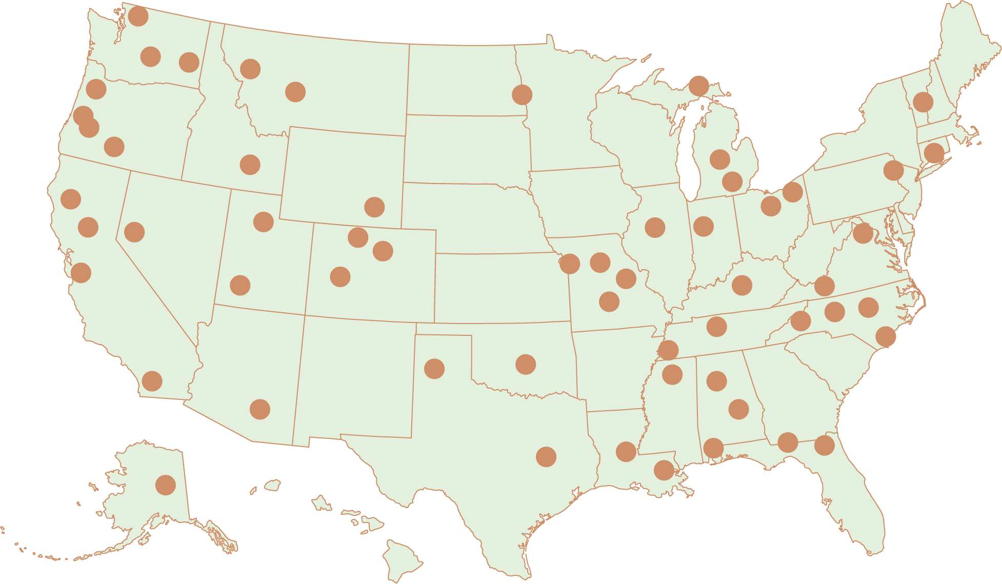
University Locations: Map of participating EDMAP universities during 2017 to 2022.
For more information, please contact:
Michael Marketti, program manager
National Cooperative Geologic Mapping Program
U.S. Geological Survey
12201 Sunrise Valley Drive, MS 908
Reston, VA 20192
mmarketti@usgs.gov
(703) 648–6976
Edited by Stokely J. Klasovsky; layout and artwork by Kimber Petersen.
Suggested Citation
Shelton, J.L., Swezey, C.S., and Marketti, M., 2023, The EDMAP Program: Training the next generation of geologic mappers: U.S. Geological Survey Fact Sheet 2023–3002, 4 p., https://doi.org/10.3133/fs20233002.
ISSN: 2327-6932 (online)
ISSN: 2327-6916 (print)
| Publication type | Report |
|---|---|
| Publication Subtype | USGS Numbered Series |
| Title | The EDMAP Program: Training the next generation of geologic mappers |
| Series title | Fact Sheet |
| Series number | 2023-3002 |
| DOI | 10.3133/fs20233002 |
| Year Published | 2023 |
| Language | English |
| Publisher | U.S. Geological Survey |
| Publisher location | Reston, VA |
| Contributing office(s) | Eastern Energy Resources Science Center, National Cooperative Geologic Mapping |
| Description | 4 p. |
| Online Only (Y/N) | N |
| Additional Online Files (Y/N) | N |
| Google Analytic Metrics | Metrics page |