

Kentucky and Landsat
Links
- Document: Report (8.33 MB pdf) , HTML , XML
- Version History: Version History (2 kB txt)
- Download citation as: RIS | Dublin Core
Abstract
From its rolling pastures to its forested Appalachian peaks, Kentucky’s scenery offers beauty along with contrast. Rivers, including the Mississippi and the Ohio, border much of the State, and more rivers and hundreds of lakes are inside its borders. Kentucky is also home to the world’s longest known cave system, Mammoth Cave National Park, and its residents maintain long-held traditions of coal mining, farming, horse racing, and bourbon making.
Although residents and visitors have a lot to explore up close, viewing Kentucky through a long lens—one extending into space—can offer even more information about its environmental and natural resources. Landsat satellite data can help State and Federal governments monitor the quality and health of Kentucky’s lands and waters.
Here is a closer look at some of the many ways that Landsat benefits Kentucky.
Assessing Wildfire Effects
Landsat data are used to map wildfire perimeters across the United States. In Kentucky, wildfire seasons are in spring and fall and include hundreds of fires each year. One 1,600-acre fire in Daniel Boone National Forest, the 2010 Fish Trap Fire, gave the U.S. Forest Service and university researchers the opportunity to dive deeper into the question of how wildfires, as opposed to prescribed burns, affect vegetation response in an Appalachian forest setting over time—including whether non-native species tend to invade. Landsat imagery provided pre-burn vegetative data and was also used to create a wildfire severity map (Black and others, 2018).
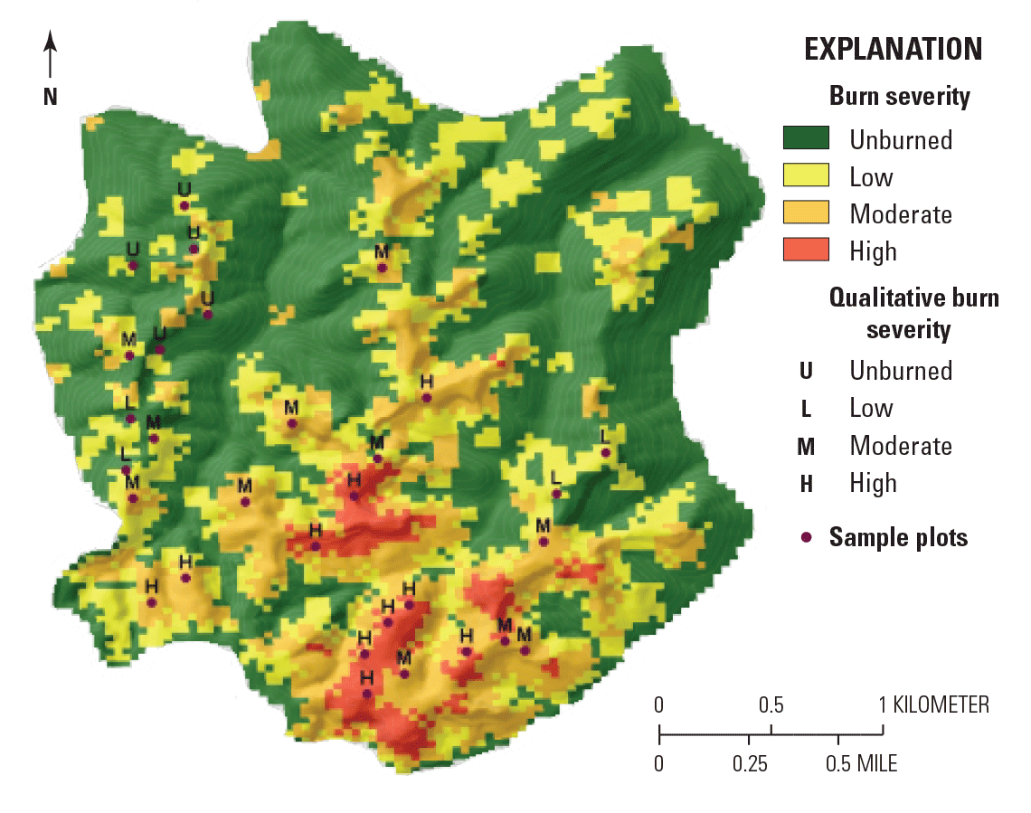
Locations of visual burn assessments on top of ranges of burn severity derived from Landsat data, Fish Trap Fire site, Daniel Boone, National Forest. Image credit: Suraj Upadhaya (Upadhaya, 2015); used with permission.
Monitoring Potential Harm
Toxins from cyanobacteria produce harmful algal blooms (HABs) that can turn lakes used for recreation and water sources into a public danger. Unfortunately, the State’s many lakes can make widespread sampling and observation impractical. The Kentucky Division of Water has used Landsat imagery to save time and labor by efficiently detecting HABs across wide areas. Models based on the imagery can predict trends for the timing and location of HABs. When an outbreak is suspected, ground verification may lead to a public advisory (Stillings, 2015). Meanwhile, a NASA DEVELOP Program team used Landsat vegetation information to help assess flooding and landslide risks for the vulnerable cities of Covington, Kentucky, and Cincinnati, Ohio, which are separated by the Ohio River (LaJoie and others, 2021).
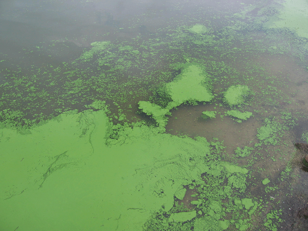
Harmful algal blooms can release toxins into the environment. Photograph credit: Jennifer L. Graham, U.S. Geological Survey.
A Bigger View of Parks and Forests
National parks and forests offer many opportunities to enjoy Kentucky’s scenery. Landsat helps park officials manage these areas for the benefit of all. In and around Cumberland Gap National Historic Park, Landsat imagery helped to differentiate types of land cover and where changes have occurred, and to identify areas of potential wildlife habitat (Sundin and others, 2013). Models using Landsat imagery also helped the U.S. Forest Service assess the amount of carbon stored in Daniel Boone National Forest (Dugan and others, 2019).
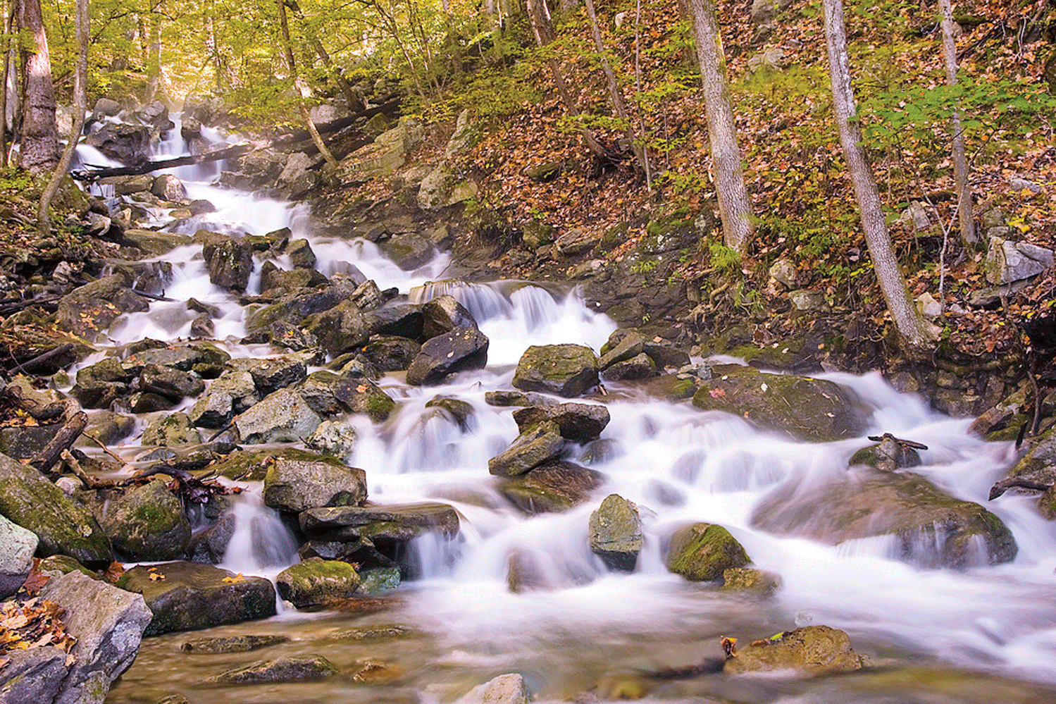
A cascade is part of the diverse landscape and habitat in Cumberland Gap National Historical Park in Kentucky. Photograph credit: Scott Teodorski, National Park Service; used with permission.
National Land Imaging Program Benefits—Kentucky
The U.S. Geological Survey (USGS) National Land Imaging Program provides a wide range of satellite imagery and other remotely sensed and geospatial data to Government, commercial, academic, and public users. Those users can get worldwide access to Landsat satellite data through the National Land Imaging Program-funded USGS Earth Resources Observation and Science (EROS) Center.
Landsat—Critical Information Infrastructure for the Nation
Landsat is the most widely used land remote sensing data source within Federal civilian agencies. Local, State, Tribal, and Federal agencies use Landsat to monitor and forecast a wide range of land surface phenomena. Information from Landsat contributes to day-to-day decisions on land, water, and resource use that protect life and property; safeguard the environment; advance science, technology, and education; support climate change resiliency; and grow the U.S. economy. Landsat’s imagery provides a landscape-level view of land surface, inland lake, and coastal processes, both natural and human-induced. Landsat enables us to better understand the scope, nature, and speed of change to the natural and built environment.
Businesses draw upon Landsat data to provide customer-specific applications to improve logistics, resource allocation, and investment decisions. Commercial space imaging firms leverage Landsat data to refine product offerings and support new information services. A 2017 USGS study determined the total annual economic benefit of Landsat data in the United States. to be $2.06 billion, far surpassing its development and operating costs (Straub and others, 2019).
Landsat 8 and Landsat 9 provide 8-day repeat coverage of the Earth’s land surfaces. The National Aeronautics and Space Administration (NASA) and the USGS are currently reviewing the findings from a joint Architecture Study Team, which will inform the design and implementation approach for Landsat Next, the follow-on mission to Landsat 9. Landsat 9 and its successors are planned to provide a sustainable, space-based system to extend the 50-year Landsat series of high-quality global land imaging measurements—the world’s longest time series of the Earth’s land surface.
The long-term availability of consistent and accurate Landsat data, combined with a no-cost data policy, allows users to analyze extensive geographic areas and better understand and manage long-term trends in land surface change. New cloud computing and data analytics technologies use Landsat data in a wide range of decision-support tools for Government and industry. Much like global positioning systems and weather data, Landsat data are used every day to help us better understand our dynamic planet.
References Cited
Black, D.E., Poynter, Z.W., Cotton, C.A., Upadhaya, S., Taylor, D., Leuenberger, W., Blankenship, B., and Arthur, M., 2018, Post-wildfire recovery of an upland oak−pine forest on the Cumberland Plateau, Kentucky: Fire Ecology, v. 14, art. 14, accessed February 23, 2022, at https://doi.org/10.1186/s42408-018-0013-9.
Dugan, A., McKinley, D., and Vadala, C., 2019, Forest carbon assessment for the Daniel Boone National Forest in the Forest Service’s Southern Region: U.S. Department of Agriculture Forest Service white paper, accessed February 23, 2022, at https://www.fs.usda.gov/nfs/11558/www/nepa/107499_FSPLT3_5220499.pdf.
LaJoie, P., Cronin, E., Perrotti, J., Shives, E., and Webster, S., 2021, Cincinnati & Covington urban development II—Assessing flooding and landslide susceptibility along the Ohio-Kentucky border: National Aeronautics and Space Administration DEVELOP Technical Report, accessed February 23, 2022, at https://static1.squarespace.com/static/5d8a770ae5560358911d081f/t/6151ebbbee776231ddd5fb2e/1632758717386/2021Sum_MA_Cincinnati%26CovingtonUrbanII_TechPaper_FD-final+%281%29.pdf.
Stillings, G., 2015, Monitoring HABs using satellite imagery: Kentucky Energy and Environment Cabinet,Land, Air & Water publication, Summer 2015, accessed February 23, 2022, at https://eec.ky.gov/Land%20Air%20Water/Summer%202015.pdf.
Straub, C.L., Koontz, S.R., and Loomis, J.B., 2019, Economic valuation of Landsat imagery: U.S. Geological Survey Open-File Report 2019–1112, 13 p., accessed February 23, 2022, at https://doi.org/10.3133/ofr20191112.
Sundin, G., Worsham, L., Nibbelink, N., Grossman, G., and Mengak, M.T., 2013, Natural resource condition assessment for Cumberland Gap National Historical Park: Fort Collins, Colo., National Park Service, Natural Resource Report NPS/CUGA/NRR—2013/620, accessed February 23, 2022, at http://www.npshistory.com/publications/cuga/nrr-2013-620.pdf.
Upadhaya, S., 2015, Use of Landsat data to characterize burn severity, forest structure and invasion by Paulownia (Paulownia tomentosa) in an eastern deciduous forest, Kentucky: Theses and Dissertations—Forestry and Natural Resources, no. 23, M.S. thesis, accessed February 23, 2022, at https://uknowledge.uky.edu/forestry_etds/23.
For additional information on Landsat, please contact:
Program Coordinator
USGS National Land Imaging Program
12201 Sunrise Valley Drive
Reston, VA 20192
703–648–4567
The Landsat series is a joint effort of USGS and NASA. NASA develops and launches the spacecraft; USGS manages satellite operations, ground reception, data archiving, product generation, and data distribution. Funding for the National Land Imaging Program’s Landsat operations and data management is provided through the USGS.
Suggested Citation
U.S. Geological Survey, 2022, Kentucky and Landsat (ver. 1.1, January 2023): U.S. Geological Survey Fact Sheet 2022–3017, 2 p., https://doi.org/10.3133/fs20223017.
ISSN: 2327-6932 (online)
ISSN: 2327-6916 (print)
Study Area
| Publication type | Report |
|---|---|
| Publication Subtype | USGS Numbered Series |
| Title | Kentucky and Landsat |
| Series title | Fact Sheet |
| Series number | 2022-3017 |
| DOI | 10.3133/fs20223017 |
| Edition | Version 1.0: March 24, 2022; Version 1.1: January 18, 2023 |
| Year Published | 2022 |
| Language | English |
| Publisher | U.S. Geological Survey |
| Publisher location | Reston, VA |
| Contributing office(s) | Earth Resources Observation and Science (EROS) Center |
| Description | 2 p. |
| Country | United States |
| State | Kentucky |
| Online Only (Y/N) | N |
| Google Analytic Metrics | Metrics page |